GÜSSEFELD, FRANZ LUDWIG: MAP OF DALMATIA AND NEIGBOURING LANDS
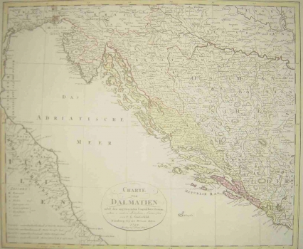
This is the first edition of Güssefeld’s map whose second edition appeared in 1806. Güssefeld’s map of Dalmatia and neighbouring countries shows the territory that includes almost all lands that are today Croatia (the only area not shown on the map is the Northwestern Croatia). The boundaries of the Croatian lands of that period: Croatia, Slavonia, Istria and Dalmatia are delineated exactly as they were fixed by the Treaty of Svistov signed in 1791 at the end of the last Austrian-Turkish war. Of particular interest is that the map shows the two main roads in that territory, the so-called Josephine and Caroline roads, as well as some other roads in the region of Slavonia and Dalmatia. The title of the map appears within one simple circle in the lower part of the map. The map’s scale is in German, Italian, Turkish and Hungarian miles.
GÜSSELEFLD, FRANZ LUDWIG
