GOERÖG (GORÖG), DEMETER: THE DISTRICT OF ZAGREB
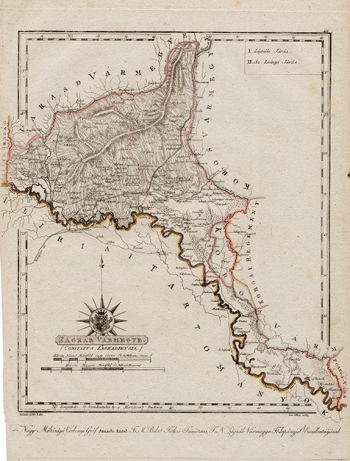
This map was published in the "Magyar Atlas ...", which contains the first representation of Croatian counties and regiments. The second edition of the Atlas was printed in Budapest and published in 1839. The view of the Zagreb County is interesting for several reasons. First, the county stretches to the east and to the north to the Sutla River and Krapina, to the west to the Lonja River, but to the south only to the Sava River, because the entire area south of Sava beceme a part of the French Illyrian Provinces. Secondly, Zagreb is depicted as a fortress with 5 towers, and it is obvious that it is Grič / Gradec, surrounded by Črnomerec, Trnje, Markuševac and other villages, which are now part of the city. Great attention is given to the relief, so it seems a large part of the county is dominated by the Zagreb Mountin (Zagrebačka gora).
GOERÖG (GORÖG), DEMETER
