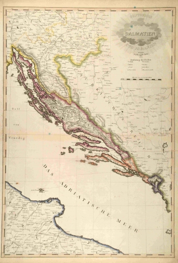
MOLLO, TRANQUILLO: MAP OF DALMATIA
Mollo's map shows Dalmatia in the short period of the first Austrian rule, established between 1797 and 1806, after which in 1806 the French administration was later organized as Napoleon's Illyrian Provinces. Violet colours indicate Dalmatian borders and pale red indicates the border of the Dubrovnik Republic several years before its abolition (it was abolished by the French in 1808). Croatia is bordered by yellow colour, and Bosnia, still in the Ottoman Empire, is green. Under Habsburg rule, there was also Boka Kotorska and part of the coast to Budva and Lastva (today Montenegro), which were part of the Venetian Republic until 1797. Relief is depicted by the new, then very modern method - the so-called hatching, or dash marks that designate the terrain configuration. Traffic communications are also marked in Croatia and Dalmatia. Moll's map of Dalmatia and Albania was engraved in stone by F. Reisser in Vienna in 1805.
MOLLO, TRANQUILLO
