SANTINI, PIETRO: MAP OF DALMATIA
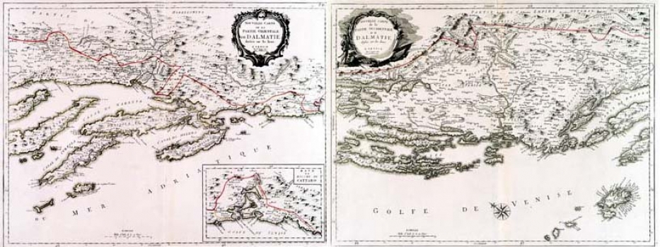
This map of Dalmatia was made by Santini, in 1780, and published by the Italian publisher Giuseppe Antonio Remondini who re-issued Sanitini's "Atlas Universel" in 1783. This is the western sheet of the Santini's map of Dalmatia. It shows the border between Croatia, being part of the Hapsburg Monarchy, Bosnia being part of the Ottoman Empire and the Venetian Dalmatia. This border fixed in 1730, after the Peace Treaty of Požaarevac, was named the Mocenigo Line after Alvis Mocenigo, the then Venetian commissioner in charge for the fixing of borders. This border served as demarcation line between the Republic of Venice, thee Ottoman Empire and the Hapsburg Monarchy and stayed unchanged until the fall of Venice in 1797. That period border between Venetian Dalmatia and Bosnia constitutes today's border between the Republic of Croatia and Bosnia and Herzegovina. The title is in the map’s upper left corner. A mileage scale is expressed in Italian miles.
SANTINI, PIETRO
