ROSACCIO, GIUSEPPE: VIEW OF KLIS
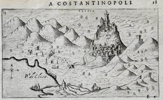
The exceptional importance of Klis, constituted the reason why its fortress with the surrounding countryside obligatorily appeared in every Venetian isolario. The map image begins from the river Jadro. Along the Golf of Kaštela the ruins of the Antique Salona are identified from which the road is leading towards Klis to connect the coast with Klis fortress and the settlement in its suburb (Brogo). After 1537, Klis was ruled by the Turks. For that reason, besides by the fortification structures, the representation of the town is dominated by the Turkish mosque with minaret. The massifs of Kozjak and Mosor are shown fictitiously. In the area surrounding Klis the rests of destructed buildings can be seen as evidence of destructive effects of war. This Rosaccio’s view appeared in the first edition of his travel-record book «Viaggio da Venetia a Constantinopoli per Mare, e per Terra, & insieme quello di Terra Santa» published in 1598.
ROSACCIO, GIUSEPPE
