REILLY, FRANZ JOHANN JOSEPH VON: MAP OF LOWER CARNIOLA
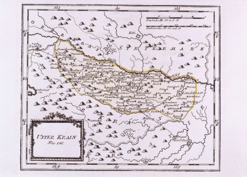
The map of the Lower Carniola shows the area comprised between the rivers Sava and Krka (which today is the region of Dolenjska), with all major settlements indicated. The network of rivers is featured quite nicely. But, as usual for Reilly's maps the topography is only indirectly suggested. The vegetation is not represented. In the focus of this map, beside the settlements, is the representation of the post routes network. It shows the post route Karlovac-Ljubljana passing though the whole territory of the southern Carniola. On this route are indicated also all of its stations. The title of the map is in the lower left corner of the map shown in a frame decorated with a blooming branch. A mileage scale in German (Deutsche M.) and Italian (Itallienische M.) miles. This map was published in Reilly's atlas "Schauplatz der Welt Atlas" 1789-1791.
REILLY, FRANZ JOHANN JOSEPH VON
