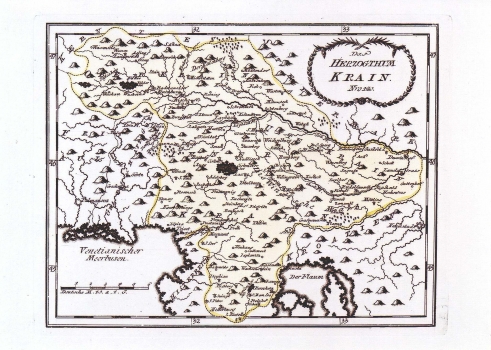
REILLY, FRANZ JOHANN JOSEPH VON: MAP OF THE DUCHY OF CARNIOLA
The map shows the whole territory of the duchy of Carniola. The Upper, Inner and Lower Carniola are shown within their administrative delimitation, as well as the Windisch Mark. In distinction from the other Reilly's maps, the settlements shown are not categorized (the only exception being part of the Upper Carniola, and the extreme southern part of Carniola). In the middle of the Lower Carniola the lake of Cernik is featured enlarged in proportion. The topography is shown arbitrarily with shaded molehills. The representation of the post routes is omitted. The title of the map is shown in the upper right corner contained in a floral garland. A mileage scale is in German miles (Deutsche M.). This map was published in Reilly's atlas "Schauplatz der Welt Atlas" 1789-1791.
REILLY, FRANZ JOHANN JOSEPH VON
