REILLY, FRANZ JOHANN JOSEPH VON: MAP OF SLAVONIA AND SRIJEM
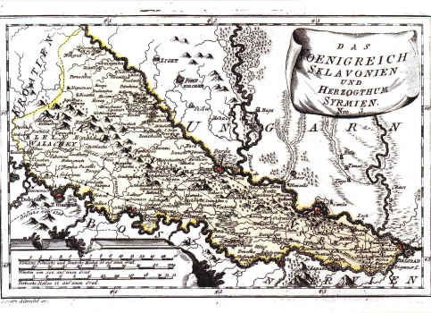
The map of the Kingdom of Slavonia and the duchy of Srijem is shown east of the river Ilova stayed under Turkish control until the Austrian-Turkish war, (1683-1699). The duchy of Srijem returned to make part of Slavonia by the Treaty of Požarevac of 1718. To the south of Sava the delineation of the whole boundary line is indicated as established by the Treaty of Požarevac according to which the demarcation line is transfered south of the flow of the river Sava. A dotted line is marking boundaries between the military and the civilian Slavonia. A continuous line shows post routes with post stations marked by a point. The fortresses of major importance bear a special red mark (Osijek, Brod, Gradiška, Petrovaradin and Zemun). The title is in the lower right corner of the map in an unrolled scroll shaped cartouche. A mileage scale is in Italian, Turkish and German miles. This map was published in Reilly's atlas "Schauplatz der Welt Atlas" (1789-1791).
REILLY, FRANZ JOHANN JOSEPH VON
