REILLY, FRANZ JOHANN JOSEPH VON: MAP OF NORTHERN DALMATIA
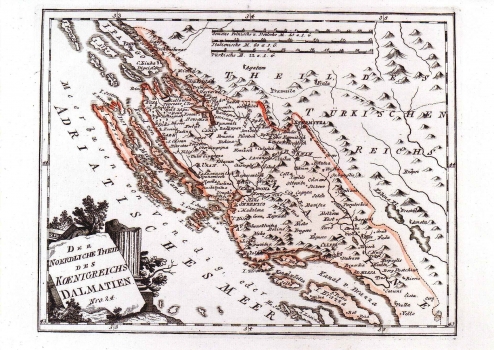
The map of the "Northern part of the Kingdom of Dalmatia" shows the coast reaching from the foot of the mount of Velebit to Makarska and its inland area. The delineation of boundaries with the Turkish Bosnia is indicated as established with the peace treaty of Požarevac of 1718, and called Linea Mocenigo, after the Governor-General of Dalmatia of that time, Alvis Mocenigo. At that time the whole Dalmatia was under administration of the Republic of Venice. The topography is shown with shaded molehills - a method that was rather outdated at the time. The title is shown in the lower left corner inscribed in a stone plate leant against ruins of antique monuments. A mileage scale is in Italian, Turkish and German miles. This map was issued in Reilly's atlas "Schauplatz der Welt Atlas" 1789-1791.
REILLY, FRANZ JOHANN JOSEPH VON
