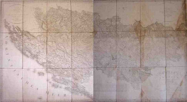
RIEDEL, ADRIAN FRANZ XAVER FLORIAN VON: MAP OF SERBIA, BOSNIA AND MUCH OF ILLYRICUM
This map of Bosnia, Serbia and parts of the Illyrian lands was based on rough drafts of the Hapsburg military topographers. Riedl’s map of Bosnia and Serbia is one of the rare maps based on information from military sources intended for the public use. For the aforesaid raison this is one of the most accurate civilian maps of Bosnia and Serbia of the time. While making his map Riedel used information gathered by the famous cartographer Johannes Lipszky von Szedliczne. Topographical features are presented with shaded relief. Riedel placed his greatest attention to the representation of the settlements and roads. The number of place names is exceptionally copious, so that Riedl’s map shows many small settlements till then not identified on any pre-existing map. However, Riedl's had not an equally complete knowledge of all of the regions covered, so, the representation of Herzegovina is set apart for its lesser quality obviously due to the fact that the information Riedl had on this region was much less copious compared to that he had on other parts of Bosnia and Serbia.
RIEDL, ADRIAN FRANZ XAVER FLORIAN VON
