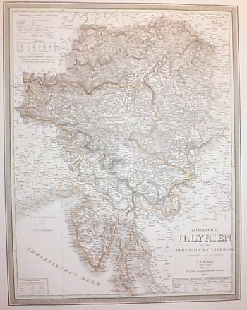
WEILAND, CARL FERDINAND: MAP OF THE KINGDOM OF ILLYRIA AND DUCHY OF STYRIA
Inventory number 315
Author: WEILAND, CARL FERDINAND
Original title: Königreich Illyrien und das Herzogthum Steyermark nach de Castro's Charte vom Inneroestreich entworfen von C. F. Weiland
Publishing year: 1840
Place of publishing and publisher: Weimar
Format: 58,5 x 46 cm
Technique: Partially coloured lithograph
This map shows the Kingdom of Illyria and Duchy of Styria. It was made in the Geographic Institute of Weimar where was active also Carl Ferdinand Weiland. He made the map after the original by Joseph Castro who made, in 1812, a map of Austrian Interior lands. Along the map’s margin statistical data on the Kingdom of Illyria and Duchy of Styria are featured. It was produced using the technique of polychrome lithography.
WEILAND, CARL FERDINAND
Carl Ferdinand Weiland (1782-1847), a German cartographer, who worked at the Geographic Institute in Weimar. His best-known works are: «Atlas von Amerika» issued between 1824 and 1828, «Hand Atlas» from 1828/29 and the map of Europe in 4 folios of 1844.
