WEIGEL, JOHANN CHRISTOPH: PLAN OF BELGRADE
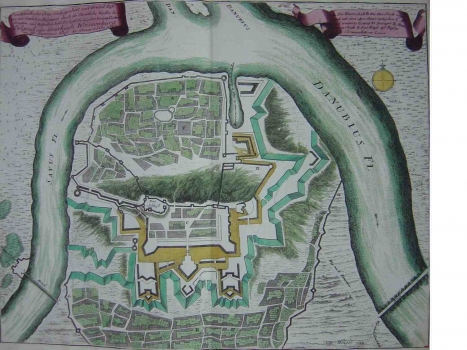
Belgrade, as one of the most important fortresses in the Serbian territory, was often the object of interest of Habsburg cartographers. The plan of Johann Christopher Weigel shows the settlement and the fortress of Belgrade as it was during the period of Austrian rule. During the 18th century Belgrade was borderland fortress situated on the frontier that divided the Habsburg Monarchy in the north and the Ottoman Empire in the south. In the period between 1717 and 1739 while under Austrian rule, over 100 original Habsburg military plans of the fortress of Belgrade were produced. One of them is Weigel's plan showing the system of defence walls and forts as they were after the reconstruction executed by the Habsburg Army. To the southeast, the fortified urban structure outside the fortress is shown, to the north is the Upper Town and above the Upper Town the fortress Kalemengdan.
WEIGEL, JOHANN CHRISTOPH
